21st Century Canon of Lunar Eclipses
By Fred Espenak
Standard Edition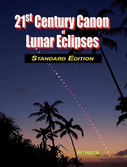
Standard Edition Features |
Deluxe Edition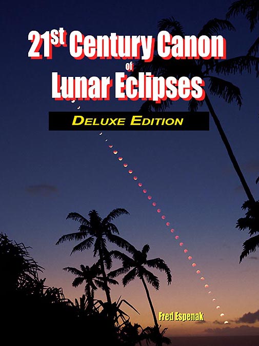
Deluxe Edition Features |
Standard Black & White Edition
|
Deluxe Black & White Edition
|
|
Standard Full Color Edition
|
Deluxe Full Color Edition
|
|
The links above all go to Amazon.com. However, you can order these books from any Amazon worldwide.
Visit any other Amazon and enter the book title in the Amazon search window. |
Description
The 21st Century Canon of Lunar Eclipses contains maps and data for all 228 lunar eclipses occurring during the 100-year period from 2001 through 2100. The eclipse predictions are based on the Jet Propulsion Lab's DE431 - a computer ephemeris used for calculating high precision coordinates of the Sun and Moon for hundreds of years into the past and future. The predictions also use a new elliptical model for Earth's shadows, which is the most rigorous and accurate method to date. Read all about this new elliptical shadow model as described in the 21st Century Canon,
Visit the following link to see the Table of Contents.
Section 1 of the Canon presents basic fundamentals including eclipse classification, the visual appearance of each type of eclipse, and the Danjon Scale of eclipse brightness. Section 2 discusses the eclipse predictions, the major contact definitions, the enlargement of Earth's shadows, coordinates of the Sun and Moon, and Delta T. Section 3 looks at the frequency of lunar eclipses, extremes in penumbral and umbral eclipse magnitudes, durations of penumbral, partial and total eclipses, and eclipse seasons. A concise explanation of the data contained in the lunar eclipse catalog (Appendix A) appears in Section 4 while Section 5 offers a complete description of the diagrams and maps presented for each lunar eclipse in Appendices B and C.
The primary content of the 21st Century Canon of Lunar Eclipses resides in the three appendices. Appendix A is a comprehensive catalog listing the essential characteristics of each eclipse. These include the calendar date and time of greatest eclipse, Delta T, lunation number, Saros series number, gamma, penumbral and umbral eclipse magnitudes, durations of the penumbral, partial and total phases, and the geographic location where the Moon appears at the zenith at greatest eclipse.
Appendix B is an atlas of figures depicting the path of the Moon through Earth's shadows and maps identifying the geographic regions of visibility of each eclipse. The 228 figures are arranged twelve to a page. Other data on each figure include the eclipse type, calendar date and time of greatest eclipse, Saros series number, lunar node, Delta T, gamma, eclipse magnitudes, and phase durations.
Appendix C zeros in on the lunar eclipses with a detailed full-page path diagrams and maps of each eclipse.
The following three images are sample pages from the Table of Contents, and Appendices A and B. Click on each to open a full-size, full-resolution sample.
Table of Contents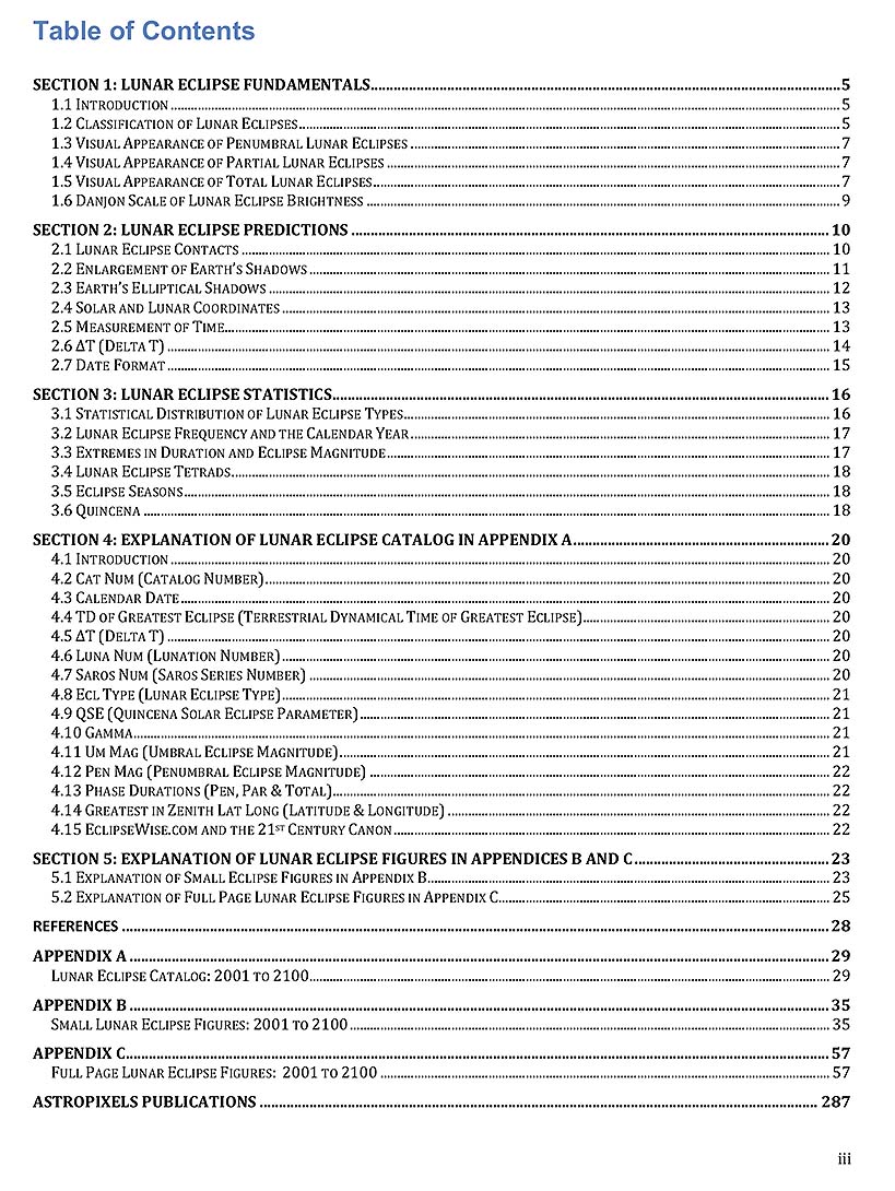
Table of Contents (click to enlarge) |
Page from Appendix A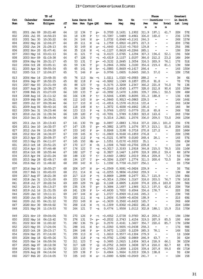
Page from Appendix A (click to enlarge) |
Page from Appendix B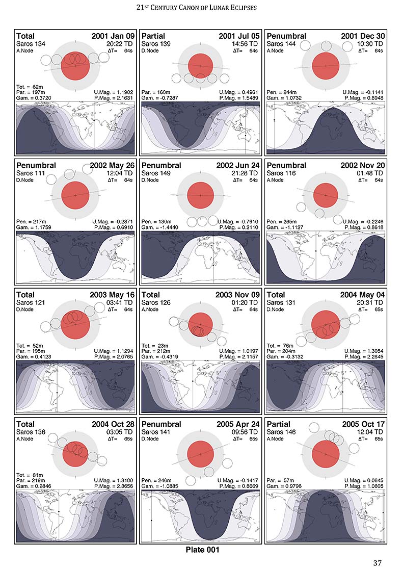
Page from Appendix B (click to enlarge) |
Appendix C contains zeros in on individual lunar eclipses with a detailed full-page path diagrams and maps of each eclipse.
The 21st Century Canon of Lunar Eclipses is available in two editions: 1) Standard Edition and 2) Deluxe Edition.
And each of them is available in either Black & White or Full Color.
The only difference between the two editions is in Appendix C.
In the Standard Edition, Appendix C contains 112 full-page diagrams and maps - one for each lunar eclipse from 2021 through 2070.
In comparison, Appendix C in the Deluxe Edition contains 228 full-page diagrams and maps - one for each lunar eclipse from 2001 through 2100.
Below is the key to the full-page diagrams and maps in Appendix C. It identifies the various features in each.
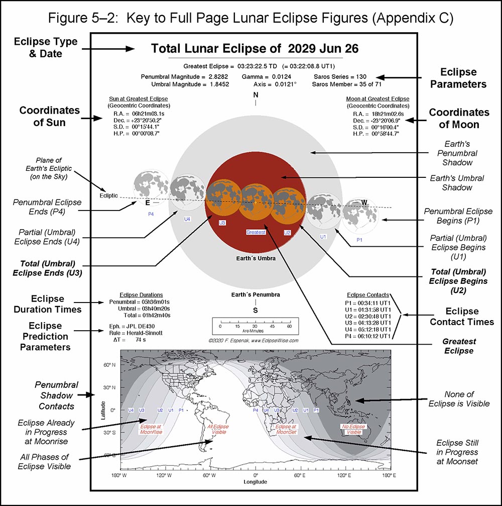
Key to Digrams and Maps in Appendix C (click to enlarge) |
Below are two examples of the full-page lunar eclipse diagrams from Appendix C. They are the Black and White and Full Color versions of the figures for the Total Lunar Eclipse of 2022 Nov 08. For comparison, the third figure to the right is from the 1987 NASA publication Fifty Year Canon of Lunar Eclipses for the same eclipse.
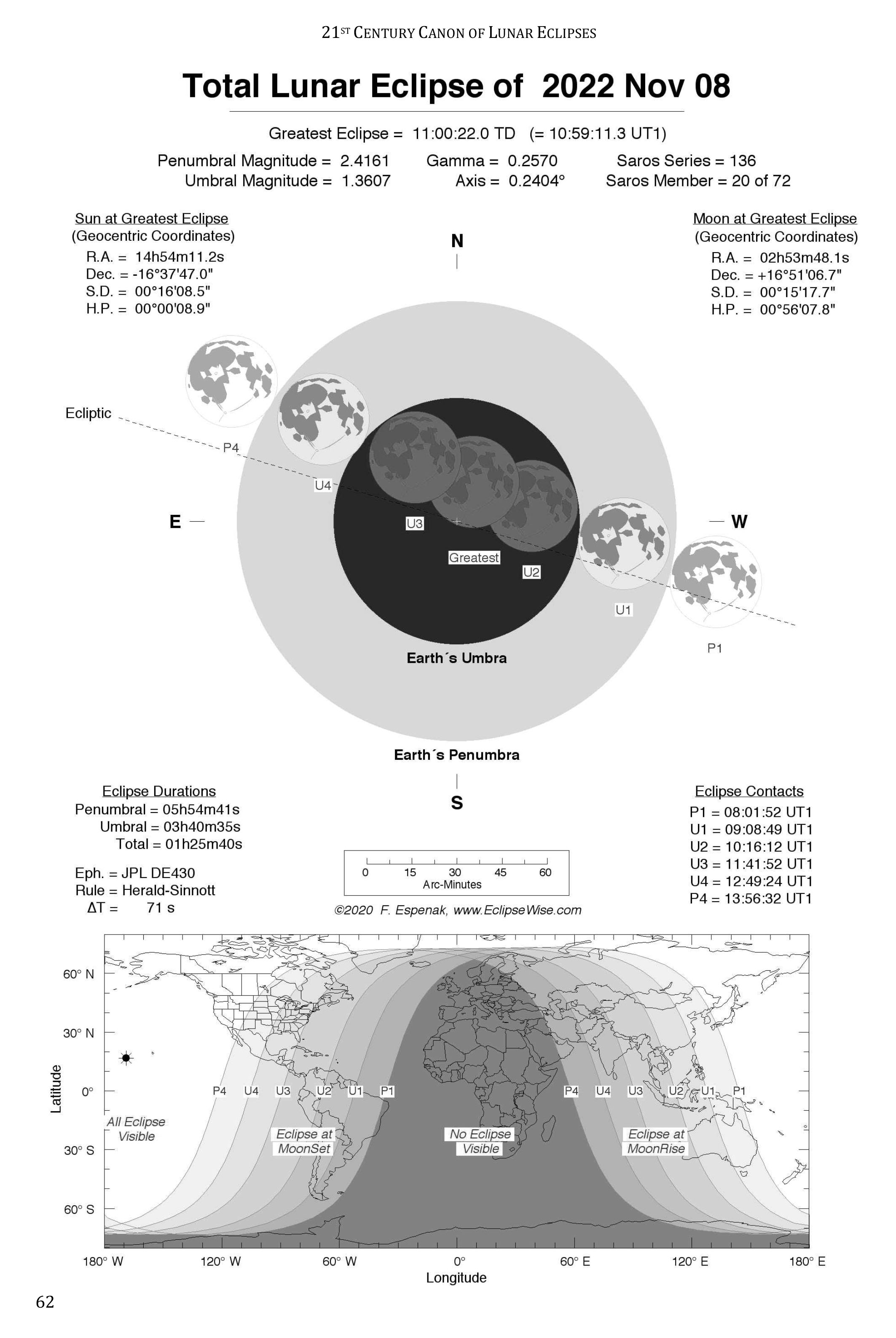
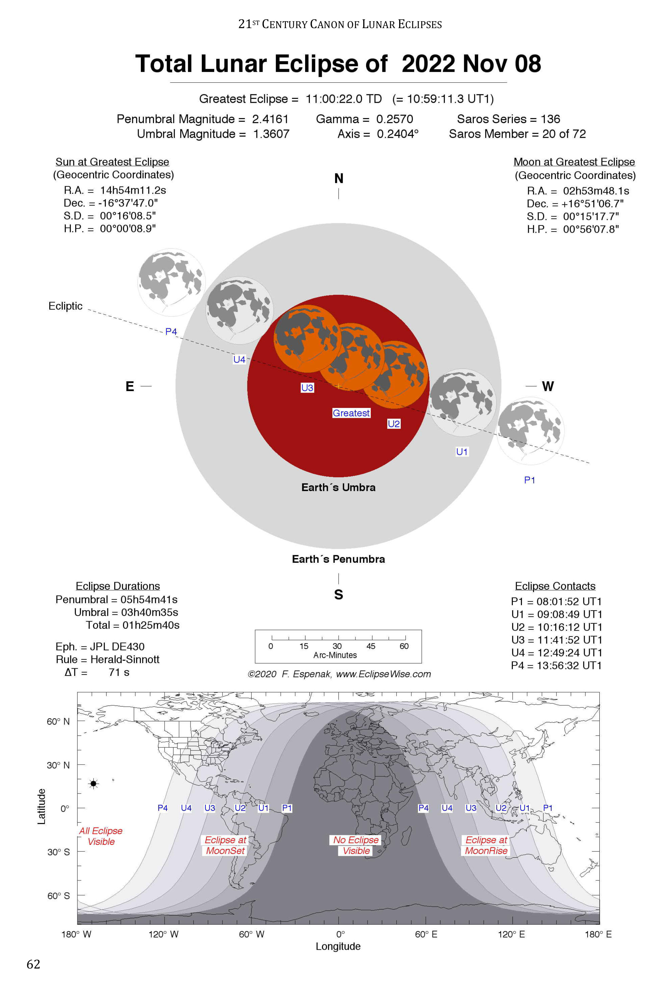
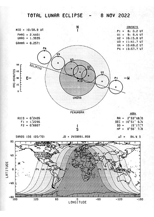
The 21st Century Canon of Lunar Eclipses is the modern successor to the NASA publication Fifty Year Canon of Lunar Eclipses. The 21st Century Canon is far more precise and includes details on the face of the Moon. It uses modern and more accurate ephemerides for the Sun and Moon (JPL DE430). It also uses an improved parameters and an elliptical model for Earth's shadows. Compare the diagrams and maps of the 2022 total eclipse from the two canons above to see the improvement.
Links for Ordering the 21st Century Canon of Lunar Eclipses
Below are links for ordering each edition from Amazon.com:
- 21st Century Canon of Lunar Eclipses - Standard Black & White Edition - (172 pages)
- 21st Century Canon of Lunar Eclipses - Standard Full Color Edition - (172 pages)
- 21st Century Canon of Lunar Eclipses - Deluxe Black & White Edition - (288 pages)
- 21st Century Canon of Lunar Eclipses - Deluxe Full Color Edition - (288 pages)
|
The links above all go to Amazon.com. However, you can order these books from any Amazon worldwide.
Visit any other Amazon and enter the book title in the Amazon search window. |
About the Author
Click the following link to read a brief biography on Fred Espenak.
More Eclipse Guides

Guide for the Total Solar Eclipse of 2026
On Wednesday, August 12, 2026, a total eclipse of the Sun will be visible from the Northern Hemisphere. The total phase in which the Moon completely covers the Sun will only be seen from within the narrow path of the Moon’s umbral shadow as it sweeps cross northern Russia, the Arctic, Greenland, Iceland, and Spain.
The Guide for the Total Solar Eclipse of 2026 contains a comprehensive series of 14 full-page maps of the path of totality across Russia, Greenland, Iceland, Spain, and the western Mediterranean. The large scale (1 inch ≈ 22 miles) through Spain shows roads, towns and cities, rivers, and lakes.
Tables for hundreds of cities provide times for each phase of the eclipse along with the duration of totality (or eclipse magnitude), and the Sun's altitude. A climatology study identifies areas along the eclipse path where the highest probability of favorable weather may be found. Finally, a brief summary is included for all total solar eclipses through 2039.
For more information visit Guide for the Total Solar Eclipse of 2026.

Guide for the Total Solar Eclipse of 2027
On Monday, August 2, 2027, a total eclipse of the Sun will be visible from the Eastern Hemisphere. Although a partial eclipse will be seen from much of Europe, Africa, and South Asia, the total phase in which the Moon completely covers the Sun will only be seen from within the narrow path of the Moon’s umbral shadow as it sweeps cross ten countries: Spain, Morocco, Algeria, Tunisia, Libya, Egypt, Sudan, Saudia Arabia, Yemen and Somalia.
The Guide for the Total Solar Eclipse of 2027 contains a comprehensive series of 20 full-page maps of the path of totality across North Africa and the Arabian Peninsula. The large scale (1 inch ≈ 40 miles) shows major roads, towns and cities, rivers, lakes, and mountain ranges. Higher resolution full-page maps (1 inch ≈ 20 miles) focus on selected areas of special interest along the path.
Circumstance tables for hundreds of cities provide times for each phase of the eclipse along with the duration of totality (or eclipse magnitude), and the Sun's altitude. Cloud statistics identify areas where the highest probability of clear sky may be found. We look at the extraordinary Saros 136 series producing the longest total eclipses. Finally, a brief summary is included for all total solar eclipses through 2039.
For more information visit Guide for the Total Solar Eclipse of 2027.
Guide for the Total Solar Eclipse of 2028
On Saturday, July 22, 2028, a total eclipse of the Sun will be visible from the Eastern Hemisphere. A partial eclipse will be seen from Southeast Asia, Indonesia, the Philippines, Australia and New Zealand. However, the total phase in which the Moon completely covers the Sun will only be seen from within the narrow path of the Moon’s umbral shadow as it sweeps cross two countries: Australia and New Zealand.
The Guide for the Total Solar Eclipse of 2028 contains a comprehensive series of 19 full-page maps of the path of totality across Australia and New Zealand. The large scale (1 inch ≈ 22 miles) shows major roads, towns and cities, rivers, lakes, and mountain ranges.
Circumstance tables for over one hundred cities provide times for each phase of the eclipse along with the duration of totality (or eclipse magnitude), and the Sun's altitude. Cloud statistics identify areas where the highest probability of clear sky may be found. Saros 146, a series which produces long total eclipses in the 20th and 21st centuries, is examined. Finally, a brief summary is given for total solar eclipses through 2039 with several passing through Australia and New Zealand.
For more information visit Guide for the Total Solar Eclipse of 2028.

Guide for the Total Solar Eclipse of 2030
On Monday, November 25, 2030, a total eclipse of the Sun will be visible from the Southern Hemisphere. Although a partial eclipse will be seen from southern Africa, Australia, and Antarctica, the total phase in which the Moon completely covers the Sun (known as totality) will only be seen from within the narrow path of the Moon’s umbral shadow as it sweeps across five countries and territories: Namibia, Botswana, South Africa, Lesotho, and Australia.
The Guide for the Total Solar Eclipse of 2030 contains a comprehensive series of 17 full-page maps of the path of totality across Africa and Australia. The large scale (1 inch ≈ 22 miles) shows major roads, towns and cities, rivers, lakes, and mountain ranges.
Circumstance tables for over one hundred cities provide times for each phase of the eclipse along with the duration of totality (or eclipse magnitude), and the Sun's altitude. Cloud statistics identify areas where the highest probability of clear sky may be found. Finally, a brief summary is given for total solar eclipses through 2039 with several passing through Australia and New Zealand.
For more information visit Guide for the Total Solar Eclipse of 2030.

Guide for the Total Solar Eclipse of 2045
On Saturday, August 12, 2045, a total eclipse of the Sun will be visible from the Western Hemisphere. A partial eclipse will be seen from most of North and South America. However, the total phase in which the Moon completely covers the Sun will only be seen from within the narrow path of the Moon’s umbral shadow as it sweeps across eleven countries and territories: the United States, the Bahamas, the Turks and Caicos Islands, Haiti, Dominican Republic, Trinidad and Tobago, Venezuela, Guyana, Suriname, French Guiana, and Brazil.
The Guide for the Total Solar Eclipse of 2045 contains a comprehensive series of 37 full-page maps of the path of totality. The large scale (1 inch ≈ 22 miles) shows major roads, towns and cities, rivers, lakes, and mountain ranges.
Tables for over two hundred cities provide times for each phase of the eclipse along with the duration of totality (or eclipse magnitude), and the Sun's altitude. Cloud statistics identify areas where the highest probability of clear sky may be found. Saros 136, the extraordinary series producing the longest total eclipses, is examined.
For more information visit Guide for the Total Solar Eclipse of 2045.

World Atlas of Central Solar Eclipses
Over the 900 year period from 1501 to 2400, Earth experiences 1395 total, annular, and hybrid eclipses of the Sun. Each of these events is visible from a narrow path across the planet as unique as a fingerprint.
The World Atlas of Central Solar Eclipses contains 81 full-page maps of every eclipse path across six continents and include coastlines, lakes, political boundaries, and major cities. Appendix A covers North and South America, Appendix B contains maps of Europe and Africa, and Appendix C is centered on Asia and Australia. Each appendix contains 27 maps covering 33 to 34 years of eclipses per map.
Additionally, Appendix D consists of a catalog that summarizes the principal characteristics of each central solar eclipse featured on the maps of Appendices A, B, and C. The catalog includes the calendar date and time of greatest eclipse, geographic coordinates of greatest eclipse, Delta T, Saros number, gamma, eclipse magnitude, Sun's altitude and azimuth, path width and central line duration.
For more information visit World Atlas of Central Solar Eclipses.
Eclipse Almanac
The Eclipse Almanac is a series of five publications. Each one is a concise reference for every eclipse of the Sun and the Moon over a 10-year period. This compendium identifies when and where each of these events will be seen. Particular details about each eclipse are included, as well as a 25-year table looking further into the future.
Section 1 presents solar eclipses including an explanation of why they occur, types of solar eclipses, and the visual appearance of each. Global maps depict the geographic regions of visibility of each of the 22 to 23 solar eclipses.
Section 2 covers lunar eclipses explaning why they occur, the types of lunar eclipses, and the appearance of each. Detailed figures illustrate each of the 22 to 23 lunar eclipses including the Moon's path through Earth's shadows, and a map of the geographic visibility of every eclipse.
Section 3 lists the date and time of the Moon’s phases over the decade.
The five volume Eclipse Almanac series covers the decades from 2021 to 2070.
For more information visit Eclipse Almanac.
21st Century Canon of Solar Eclipses
The 21st Century Canon of Solar Eclipses contains maps and data for all 224 solar eclipses occurring during the 100-year period from 2001 through 2100. The eclipse predictions are based on the Jet Propulsion Lab's DE405 - a computer ephemeris used for calculating high precision coordinates of the Sun and Moon for hundreds of years into the past and future.
Section 1 of the Canon presents the fundamentals about solar eclipses. Section 2 discusses the eclipse the predictions, the constants used. A statistical analysis of eclipse frequency, extremes in eclipse magnitude, greatest central duration and quincena combinations are covered in Section 3. A concise explanation of the data contained in the solar eclipse catalog (Appendix A) and detailed descriptions of the solar eclipse maps.
The primary content of the "21st Century Canon" resides in the four appendices. Appendix A is a comprehensive catalog of solar eclipses. Appendix B is an atlas of maps (12 per page) depicting the geographic regions of visibility of each eclipse. Appendix C zeros in on full-page maps each solar eclipse. Curves of Maximum Time and Curves of Eclipse Magnitude permit the estimation of time and magnitude from any geographic location. Finally, Appendix D plots the track of every central eclipse (total, annular and hybrid) on large scale maps to allow the identification of countries and major cities within each eclipse path.
For more information visit 21st Century Canon of Solar Eclipses.
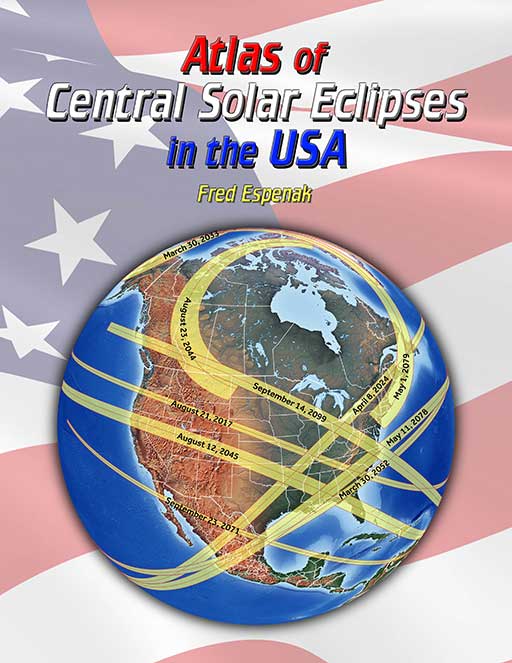
Atlas of Central Solar Eclipses in the USA
The Atlas of Central Solar Eclipses in the USA contains of a series of 499 global maps showing the geographic track of every total and annular solar eclipse across the USA (including Alaska and Hawaii) during the two-thousand-year period 1001 through 3000. It is accompanied by a catalog that lists the major characteristics of each eclipse including its duration and whether it is visible from the lower 48 states, Alaska and/or Hawaii.
A set of 20 detailed maps, each covering a 50-year period and centered on the lower 48 states, shows the path of every total and annular eclipse. The maps include state boundaries and major cities. These maps also cover southern Canada and northern Mexico.
For more information visit Atlas of Central Solar Eclipses in the USA.
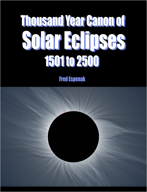
Thousand Year Canon of Solar Eclipses 1501 to 2500
The Thousand Year Canon of Solar Eclipses 1501 to 2500 contains maps and data for each of the 2,389 solar eclipses occurring over the ten century period centered on the present era.
The primary content of the Thousand Year Canon resides in the two appendices. Appendix A is a comprehensive catalog listing the essential characteristics of each eclipse.
Appendix B is an atlas of maps depicting the geographic regions of visibility of each eclipse. The zones of partial eclipse and central eclipse are plotted on an orthographic projection map of Earth. The 2,389 maps are arranged twelve to a page at an image scale permitting the assessment of eclipse visibility from any location on Earth.
Other sections of the Thousand Year Canon describe eclipse classification and the visual appearance of each type of eclipse. A statistical analysis of eclipse frequency, extremes in eclipse magnitude, greatest central duration and quincena combinations are covered.
For more information visit Thousand Year Canon of Solar Eclipses 1501 to 2500.
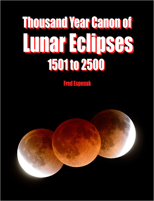
Thousand Year Canon of Lunar Eclipses 1501 to 2500
The Thousand Year Canon of Lunar Eclipses 1501 to 2500 contains diagrams, maps and data for each of the 2,424 lunar eclipses occurring over the ten century period centered on the present era.
The primary content of the Thousand Year Canon resides in the two appendices. Appendix A is a comprehensive catalog listing the essential characteristics of each eclipse.
Appendix B is an atlas of figures depicting the path of the Moon through Earth's shadows and maps identifying the geographic regions of visibility of each eclipse. The 2,424 figures are arranged twelve to a page at an image scale permitting the assessment of eclipse visibility from any location on Earth.
Other sections of the Thousand Year Canon describe eclipse classification and the visual appearance of each type of eclipse. A statistical analysis of eclipse frequency, extremes in eclipse magnitude, greatest duration and quincena combinations are covered.
For more information visit Thousand Year Canon of Lunar Eclipses 1501 to 2500.
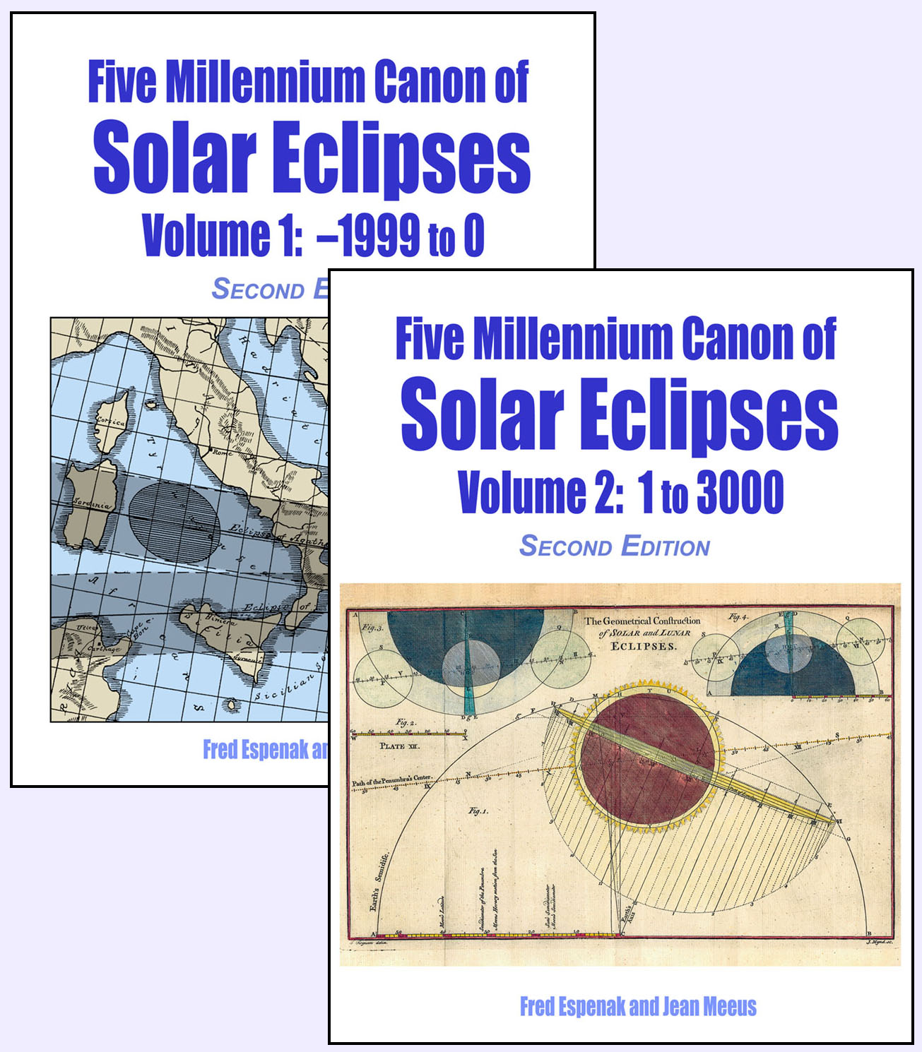
Five Millennium Canon of Solar Eclipses
The Five Millennium Canon of Solar Eclipses contains an individual geographic visibility map for each solar eclipse over 5,000 years. The maps show the regions of visibility of each phase of the eclipse.
The statistics presented include solar eclipse types by month and by century, extremes in eclipse magnitude, maximum durations of annular, hybrid and total eclipses, and eclipse duos.
Finally, the periodicity of solar eclipses is investigated regarding the Saros cycle. Details of every Saros series in progress during the Five Millennium Canon are tabulated.
The Five Millennium Canon of Solar Eclipses comprises two volumes comprises two volumes. Volume 1 covers eclipses for the years -1999 to 0, while Volume 2 covers the years 1 to 3000.
For more information visit Five Millennium Canon of Solar Eclipses.
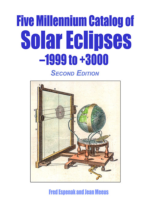
Five Millennium Catalog of Solar Eclipses: -1999 to +3000
The Five Millennium Catalog of Solar Eclipses: -1999 to +3000 serves to complement the 2-volume Five Millennium Canon of Solar Eclipses. It contains a detailed catalog listing over a dozen parameters for each eclipse including: calendar date, time of greatest eclipse, delta T, Saros number, eclipse type, gamma, eclipse magnitude, geographic coordinates of greatest eclipse, and more.
The statistics of solar eclipse frequency are investigated including eclipse types by century, extremes in eclipse magnitude, and maximum durations of total, annular, and hybrid eclipses.
The Saros cycle shows how it governs the periodicity of eclipses, and details for every of every Saros series in progress are presented.
For more information visit Five Millennium Catalog of Solar Eclipses: -1999 to +3000.
21st Century Canon of Lunar Eclipses
The 21st Century Canon of Lunar Eclipses contains figures, maps and data for all 228 lunar eclipses occurring during the 100-year period from 2001 through 2100. The eclipse predictions are based on the Jet Propulsion Lab's DE431 - a computer ephemeris used for calculating high precision coordinates of the Sun and Moon for hundreds of years into the past and future.
Section 1 of the Canon presents the fundamentals about lunar eclipses. Section 2 discusses the eclipse the predictions and the enlargement of Earth's shadows. An analysis of eclipse frequency, and the extremes in penumbral and umbral eclipse magnitudes, and durations of penumbral, partial and total eclipses are covered in Section 3.
The primary content of the "21st Century Canon" resides in the three appendices. Appendix A is a comprehensive catalog of lunar eclipses. Appendix B is an atlas of diagrams (12 per page) depicting the Moon's path through Earth's shadows and the geographic region of visibility of each eclipse. Appendix C zeros in on the lunar eclipses with a detailed full-page path diagrams and maps of each eclipse.
For more information visit 21st Century Canon of Lunar Eclipses.
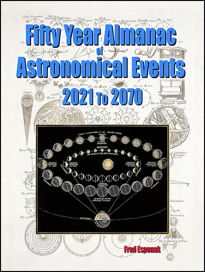
Fifty Year Almanac of Astronomical Events: 2021 To 2070
The Fifty Year Almanac of Astronomical Events: 2021 To 2070 is a catalog listing a wide range of solar system phenomena as seen from Earth. Each year gives a concise compendium of the most conspicuous and/or significant astronomical events involving the Sun, Moon and the planets.
The statistics of solar eclipse frequency are investigated including eclipse types by century, extremes in eclipse magnitude, and maximum durations of total, annular, and hybrid eclipses.
With 200+ events each year, the Fifty Year Almanac includes over 10,200 astronomical events.
For more information visit Fifty Year Almanac of Astronomical Events: 2021 To 2070.
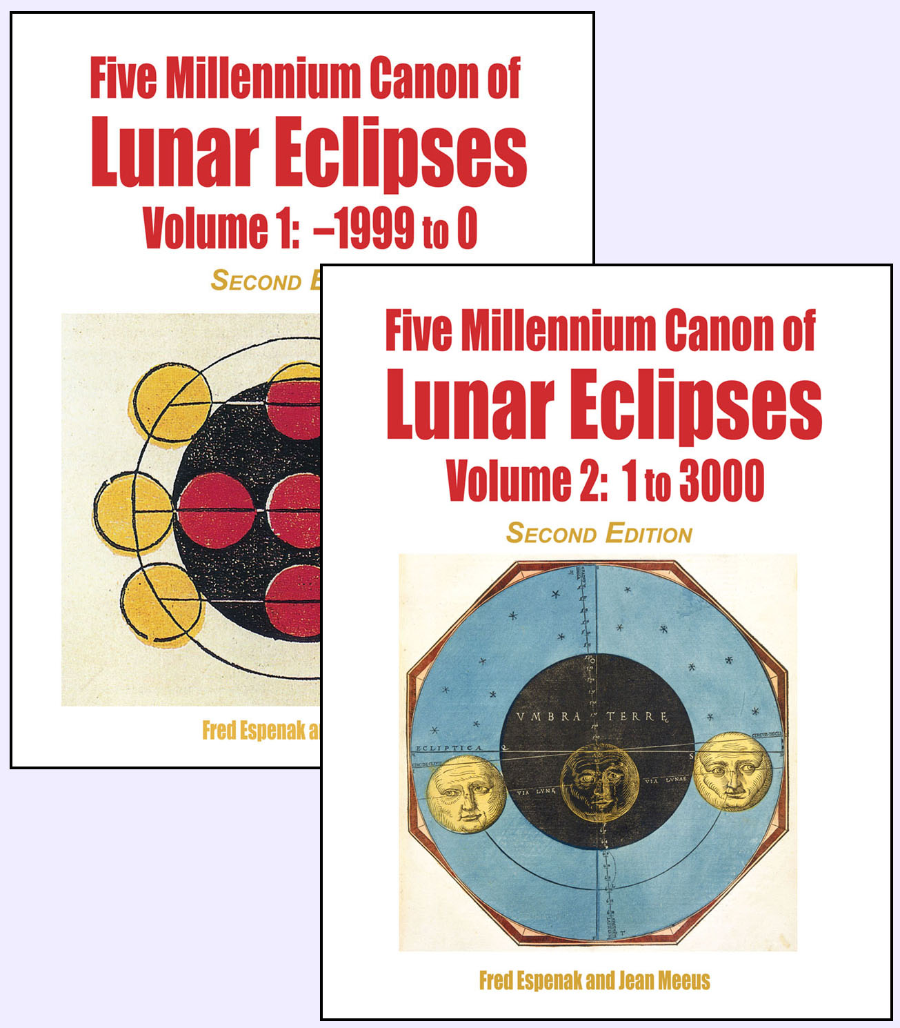
Five Millennium Canon of Lunar Eclipses
The Five Millennium Canon of Lunar Eclipses contains an individual figure and geographic visibility map for each Lunar eclipse over 5,000 years for a total of 12,064 eclipses. The figures show the Moon's path through Earth's shadows, while the maps show the geographic regions of visibility for each phase (penumbral, partial, and total).
The statistics presented include lunar eclipse types by month and by century, extremes in eclipse magnitude, maximum durations of penumbral, partial and total eclipse phases, and eclipse duos.
Finally, the periodicity of Lunar eclipses is investigated regarding the Saros cycle. Details of every Saros series in progress during the Five Millennium Canon are tabulated.
The Five Millennium Canon of Lunar Eclipses comprises two volumes comprises two volumes. Volume 1 covers eclipses for the years -1999 to 0, while Volume 2 covers the years 1 to 3000.
For more information visit Five Millennium Canon of Lunar Eclipses.
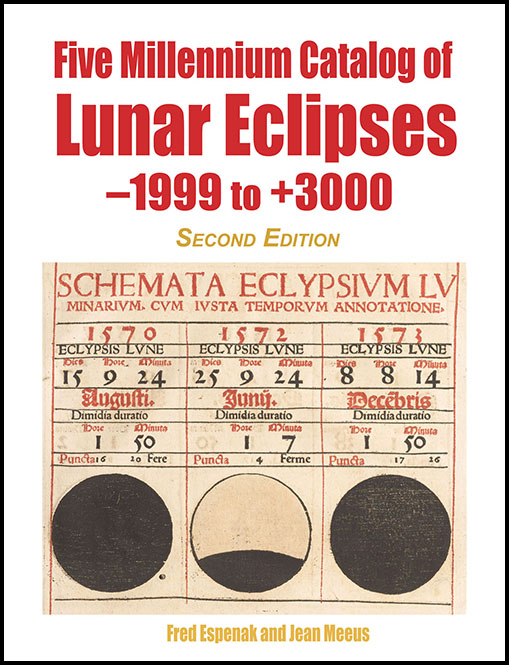
Five Millennium Catalog of Lunar Eclipses: -1999 to +3000
The Five Millennium Catalog of Lunar Eclipses: -1999 to +3000 serves to complement the 2-volume Five Millennium Canon of Lunar Eclipses. It contains a detailed catalog listing over a dozen parameters for each eclipse including: the calendar date, time of greatest eclipse, delta T, lunation number, Saros number, eclipse type, gamma, penumbral and umbral eclipse magnitudes, geographic coordinates of greatest eclipse, and the duration of each phase (penumbral, partial, and total).
The statistics presented include lunar eclipse types by month and by century, extremes in eclipse magnitude, maximum durations of penumbral, partial and total eclipse phases, and eclipse duos.
The Saros cycle shows how it governs the periodicity of eclipses, and details for every of every Saros series in progress are presented.For more information visit Five Millennium Catalog of Lunar Eclipses: -1999 to +3000.
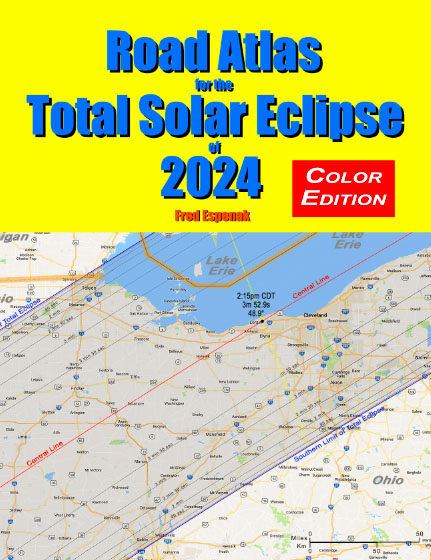
Road Atlas of the Total Solar Eclipse of 2024
The Road Atlas for the Total Solar Eclipse of 2024 contains a comprehensive series of 26 maps of the path of totality across Mexico, the USA and Canada. The large scale (1 inch ≈ 22 miles) shows both major and minor roads, towns and cities, rivers, parks, and mountains.
Although a partial eclipse will be seen from all of North America, the total phase in which the Moon completely covers the Sun (known as totality) will only be seen from within the 120-mile-wide path of the Moon’s umbral shadow as it sweeps across Mexico, the United States (Texas, Oklahoma, Arkansas, Missouri, Tennessee, Kentucky, Illinois, Indiana, Ohio, Michigan, Pennsylvania, New York, Vermont, New Hampshire, and Maine), and Canada (Ontario, Quebec, New Brunswick, Prince Edward Island, Nova Scotia and Newfoundland).
Armed with this atlas and the latest weather forecasts, the road warrior is ready to chase totality no matter where it takes him/her along the entire path. This mobile strategy offers the highest probability of witnessing the spectacular 2024 total eclipse in clear skies.
For more information visit Road Atlas for the Total Solar Eclipse of 2024.
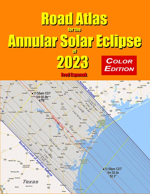
Road Atlas of the Annular Solar Eclipse of 2023
The Road Atlas for the Annular Solar Eclipse of 2023 contains a series of 29 maps of the path of annularity across the USA, Mexico, Central and South America. The large scale (1 inch ≈ 28 miles) shows both major and minor roads, towns and cities, rivers, parks, and mountains.
The annular eclipse phase in which the Moon is completely silhouetted in front of the Sun (known as annularity) will only be seen from within the 115 to 137 mile-wide path of the Moon’s antumbral shadow as it sweeps across the United States (Oregon, California, Idaho, Nevada, Utah, Colorado, Arizona, New Mexico, and Texas), Mexico, Central and South America.
Armed with this atlas and the latest weather forecasts, the road warrior is ready to chase annularity no matter where it takes him/her along the entire path. This mobile strategy offers the highest probability of witnessing the amazing 2023 annular eclipse in clear skies.
For more information visit Road Atlas for the Annular Solar Eclipse of 2023.